
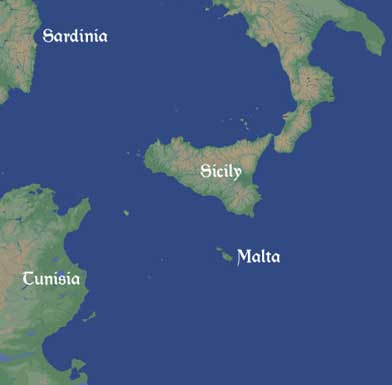
The Maltese Archipelago
Malta, and the smaller islands of Gozo and Comino, are about as close as you can get to the mid-point of the Mediterranean, being about 1,800 kilometres from the Straits of Gibraltar and 1,900 from Beirut. It is about a quarter of the way between Europe and Africa and is in a position to control traffic sailing through or across the Straits of Sicily. The strategic importance of the archipelago has been considerable in the past, particularly during the sixteenth century, when the expansion of the Ottoman empire 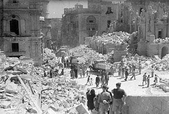 threatened the very existence of western Europe, and the Napoleonic Age when the British Royal Navy established the Grand Harbour as one of its principal bases. Malta was the key to Allied success in the North African campaign of the Second World War when its inhabitants were awarded the George Cross for their courage in the face of prolonged and intensive Axis bombing (right).
In prehistoric times, however, Malta was decidedly off the beaten track. Although not completely disconnected from the wider world around it, Malta seems to have gone pretty much its own way with little outside influence. Connections appear to have been maintained, intermittently at least, with Sicily and North Africa throughout this period but it was not until around the middle of the first millennium BC that the islands became a permanent part of the Mediterranean world as first the Greeks and then the Phoenicians established settlements there.
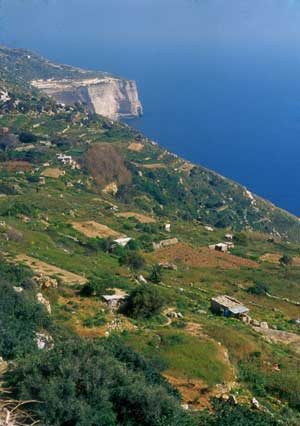
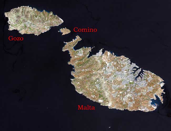
The islands are small. Malta is only about 30 kilometres long and about half that distance across while Gozo is only about one-third the size. Today they are pretty much bare of trees—apart from the old hunting park of the Knights of Saint John—but, prior to the Bronze Age when there began to be a high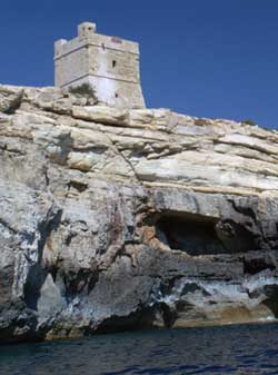 demand for fuel to smelt metal, the landscape was forested with pine and oak. They were formed out of layers deposited during the Miocene, millions of years ago. The lowest are composed of a very durable Coralline limestone, formed from ancient coral, which is difficult to carve but which can be split into building slabs with relative ease. Above that is a layer of much softer Globigerina limestone, formed from the skeletons of minute marine creatures which had settled on the seabed. Next is a layer of blue clay, useful for pottery, then a thin layer of Greensand and finally another layer of Coralline. The sequence can be clearly seen (left) at the Blue Grotto. The Coralline appears as a broad, grey band rising up from the sea and the Globigerina is the softer, honey-coloured stone above it. The quality of the stone was excellent for architectural purposes—hard Corallines for the more exposed parts and soft, beautifully coloured Globigerinas for the interiors and its availability was a key factor in the siting of the neolithic temples.
Until the Holocene, the islands were part of a land-bridge linking Sicily and North Africa. To the east and west were vast freshwater lakes but this all changed after the end of the last Ice Age (some ten thousand years ago). Rising sea levels eventually breached the barrier at Gibraltar and huge amounts of salt water flooded the basin, submerging all but the highest bits of land and isolating the archipelago and its unique wild life from the rest of Europe and Africa.
Malta sits on the edge of the African Plate, where it meets the Eurasian (they are moving apart) and faulting is a major feature of the landscape, creating a series of alternating ridges and valleys in  the north of the island. The impervious layer of clay underlying the fractured limestone means that the islands are well-provided with springs. This is of vital importance as the average rainfall is only 550mm per year and that falls mainly in the winter months. The soil is reasonably good for farming but, since the virtual disappearance of trees, it has been prone to serious erosion. The islands probably never had much in the way of timber and what little there was had disappeared by the end of the Neolithic.
Apart from building stone, the islands are generally short of natural resources—good quality flint; obsidian and metal ores are lacking. Population estimates are notoriously iffy, but a ‘carrying capacity’ of about 10,000 people would seem about right for the islands in the prehistoric period.